Iyonada / Cape Sada Setokaze Kaido
【81.8km】Travel across Japan's longest island; Cape Sada
Iyonada / Cape Sada Setokaze Kaido
【81.8km】Travel across Japan's longest island; Cape Sada
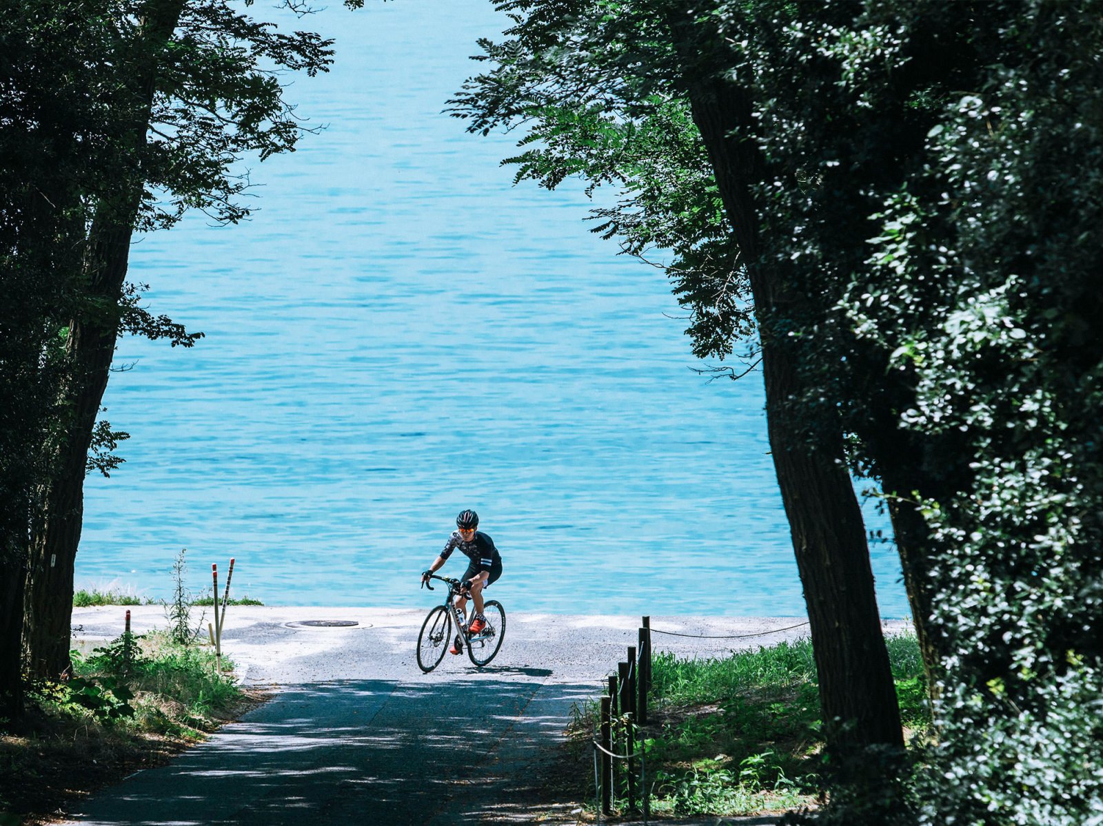
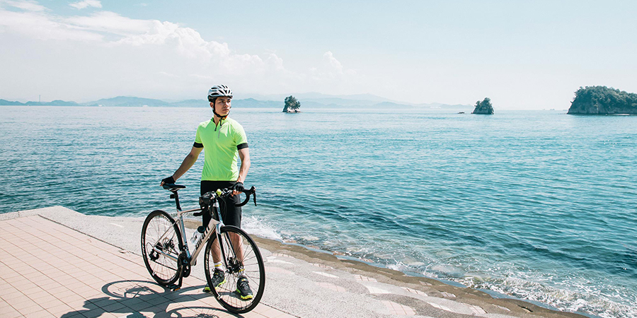
This route, covering a total distance of 81.8 kilometers, leads to the westernmost peninsula in Shikoku, and the longest and narrowest peninsula in Japan, Cape Sada. The first half of the course, the Yuyake-koyake Line, is mostly flat with few ups and downs for some distance, allowing you to enjoy the view of the calm Iyonada waters and the seasonal flowers along the way as you ride.
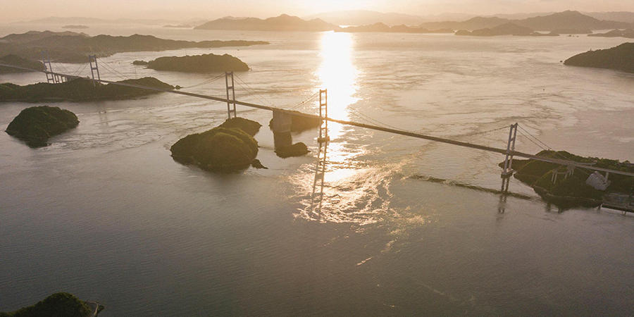
Uphill and downhill sections become frequent and there are many tunnels starting at the central part of the route after crossing the Nagahamao Bridge and entering Cape Sada. so both endurance and caution is required. The Melody Line towards the latter part of the route allows you to see the waters of both the Iyonoda and Uwakai seas on either side as you ride, providing an experience you will not find anywhere else.
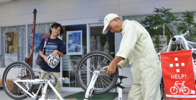
The starting point of the route at Iyo Shiyosai Park is just 3 kilometers from JR Iyoshi Station, and about 13 kilometers via prefectural route 33 from Matsuyama Airport (or about 30 minutes by car). Either distance can be traveled by bicycle, so those bringing their bicycles can get ready at the Cycle Station at Matsuyama airport and start riding from there.
However, beginners who wish to rent a bicycle should be aware that the majority of the rental bicycle shops along the route are found near JR Iyo-Nagahama Station along the central part of the route. For that reason, we recommend that beginners should rent a bicycle near Iyo-Nagahama Station and then head to Cape Sada from Nagahamao Bridge, or head back along the route to Iyo Shiosai Park.
Spots
-
start
Iyo City Shiosai Park
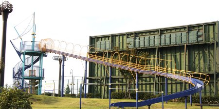
This park faces the Seto Inland Sea, offering to visitors the comforting sounds of waves and the scent of the sea. With open fields for enjoying sports such as baseball and tennis, a lawn park perfect for taking a relaxing walk along the sea, and an athletic playground designed with the themese "bottom of the ocean" and "exploration". Both young and old can find their own way of enjoying this park.
Address:91-1 Moriko, Iyo, Ehime Prefecture View in Google Maps
View Official Website -
10.5km
Futami Seaside Park / Sunset Soft Serve Ice Cream
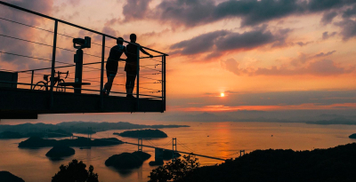
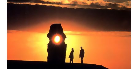
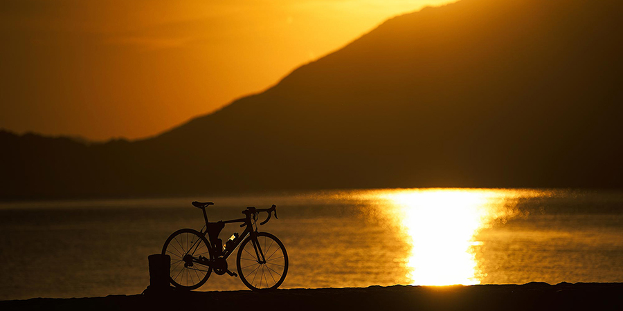
If you are looking for the perfect sunset spot, there is no place quite like Futami Seaside Park. Futami Town, where the park is located, is so famous for its beautiful sunset that their slogan is "The town where the setting sun stands still." Experience an unforgettable view of sunset and the illuminated seashore shining like gold. The sunset ice cream, Yuyake Soft Cream, with its delicate orange flavor is a must-try.
Address: 2326 Takagishi, Futami-cho, Iyo, Ehime Prefecture View in Google Maps
View Official Website -
16.1km
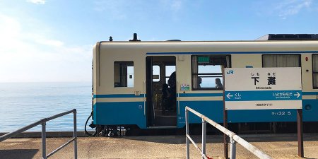
JR Shimonada Station
This unmanned but highly photogenic train station is used as a location for countless films, TV shows, ads, and magazine articles. The empty station building standing alone and the benches on the platform give a completely unhindered view of the Seto Inland Sea. Shimonada Station was once known to Japanese photographers as the very close train station to the sea. From the platform, one can view the sunlight sparkling on the ocean surface during the day, while in early evening the entire view is painted in reds and oranges. You will also notice the many seasonal flowers raised here by the locals. The station can be reached in roughly one hour on the JR line from Matsuyama Station.
Address:Okubo, Futami-cho, Iyo, Ehime Prefecture View in Google Maps
View Official Website -
28.0km
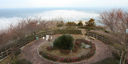
Hijikawa Storm Observatory Park
In Ozu City there is a natural phenomenon called Hijikawa Storm, which happens between the months of October to March. This phenomenon occurs when the steam billows out toward the sea, creating a scene that looks as if the town is being swallowed by a cloud. This Hijikawa Storm happens in the early morning, so you can watch the sunrise along with this dynamic natural event.
Address:785 Nagahama, Ozu, Ehime Prefecture View in Google Maps
View Official Website -
31.8km
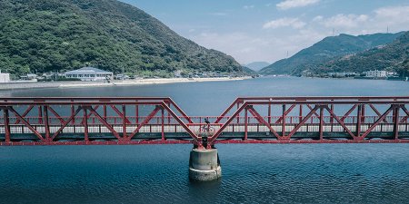
Nagahama-Ohashi
Constructed in 1935, the Nagahama Ohashi is the oldest movable bridge still in use in Japan. It has been nicknamed Akahashi, which means "red bridge", a name derived from the bridge's characteristic color. At one time the bridge would be raised every time a boat passed by. Now it is only raised and lowered for onlooking tourists. Over the years it has been at risk of destruction, either through war damage or demolition, but through preservation effors of locals, this bridge has been a part of daily life here for over 100 years.
Address:Nagahama, Ozu, Ehime Prefecture View in Google Maps
View Official Website -
53km
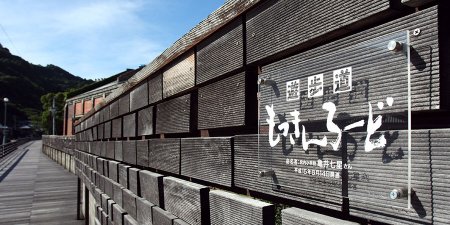
Mokkin Road (Sights of Meiji Era)
Mokkin Road, mokkin meaning xylophone in Japanese, produces a sound like a xylophone with each step. Historic structures such as a an old brick warehouse which was once Shikoku's first spinning mill, and Minase Bridge can be seen from this walking road. Monuments created by artists from Ehime can be seen here as well.
Address:Kawanoishi, Honai-cho, Yawatahama, Ehime Prefecture (along the Miyauchi River) View in Google Maps
View Official Website -
57km
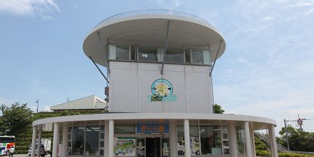
Roadside Station Ikata Kirara
The Ikata Kirara road station is found at the beginning of Sada-Misaki Hanto, Japan's longest penninsula. A plethora of local citrus fruits and seafood that can only be bought here are on display, as well as local sake from Shikoku. The view from the obsrvatory deck is definitely worth seeing as well.
Address:3-179-1 Marumachikoshi, Ikata-cho, Nishiuwa-gun, Ehime Prefecture View in Google Maps
View Official Website -
62km
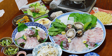
【Detour Spot】Guest House Michimoto's Seafood Shabu-shabu
Shabu-shabu is a popular Japanese dish consisting of thinly sliced fish and bite-sized vegetables cooked in steaming hot broth. In Ikata Town, fish shabu-shabu has been recognized as a local delicacy since 2011. The dish uses fresh fish from the surrounding sea, and a soup made from boiled fish bones. Topping with ponzu, a Japanese citrus-based sauce, is one common way to enjoy this, but adding local Ehime miso is also an excellent option. The lodge Michimoto serves this dish to only one group per day. Get ready for one of the most memorable (and biggest) meals of your life.
Address:973 Futami Otsu, Ikata-cho, Nishiuwa-gun, Torizu, Ehime Prefecture View in Google Maps
View Official Website -
60km
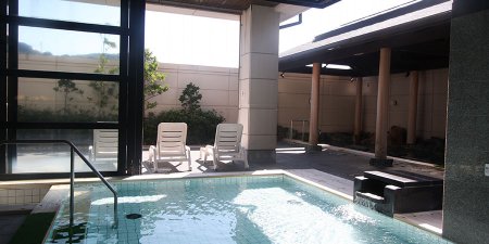
Kamegaike Hot Spring
Kamegaike Hot Spring is a hot spring bath house found on the western-most area of Shikoku. The water here comes from 1,500 meters underground. Not only can one enjoy bathing in the hot springs, but there are also saunas and bedrock baths. Plus, the restaurants serves a variety of seafood, and you can find lodging and interesting shops to explore.
Address:1289 Futami, Ikata-cho, Nishiuwa-gun, Ehime Prefecture View in Google Maps
View Official Website -
63km
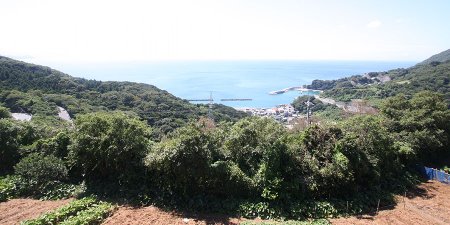
Roadside Station Seto Agricultural Park
If you travel about halfaway accross the Sada-Misaki Penninusula, you will reach the Seto Nogyo Park road station. The view from here fantastic, and the road station boasts an excellent range Ikata local delicacies. Local vegetables and restaurants with plenty of seafood dishes await.
Address:293 Shionashi Otsu, Ikata-cho, Nishiuwa-gun, Ehime Prefecture View in Google Maps
View Official Website -
68.8km
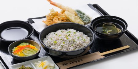
【Detour Spot】Asahi Kyohan Shirasu Park's Shirasu Bowl
Shirasu are young sardines, a much loved food in Japan. Shirasu Park is the place to go for all things shirasu. Here you can see the processing and canning of shirasu, and of course purchase the completed shirasu at the shop just nearby. At the restraurant, fresh shirasu which are served within an hour of being caught are served. Both raw shirasu and deep-fried shirasu are available.
Address: 652-1 Kawanohama, Ikata-cho, Nishiuwa-gun, Ehime Prefecture View in Google Maps
View Official Website -
68.5km
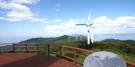
Seto Kaze no Oto Park
The 20 windmills that form a line on the ridge of the mountains are one of the spots you cannot miss when traveling Sada-Misaki. From Seto Kaze no Oka Park, you can see the whole penninsula, sandwiched by the ocean, and the windmills that traces a line like a spine, all in one view. You also can actually listen to the strong sound of windmills cutting through wind and touch the actual wings of a windmill, which is far more large in scale than most people think.
Address:Kawanohama, Ikata-cho, Nishiuwa-gun, Ehime Prefecture View in Google Maps
View Official Website -
71km
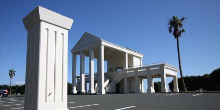
Oku Observatory
In contrast to most of the spots thus far on this route which carry a sense of Japanese nostalgia, this observatory looks kind of like a Greek temple. The view from this white building makes it feel as if the whole Uwa-Sea your kingdom. If you look back to the mountains, you can see the many windmills that generate electricity and support the people of Sada-Misaki.
Address:2370-1 Oku character Taisei, Ikata-cho, Nishiuwa-gun, Ehime Prefecture View in Google Maps
View Official Website -
Goal
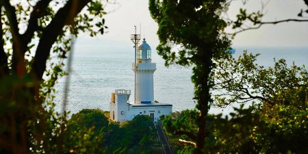
Cape Sada Lighthouse
This lighthouse towering over the tip of Cape Sada, the longest and narrowest peninsula in Japan, is part of the Setonaikai National Park and has protected the safety of ships and boats for over 100 years. While the interior of the lighthouse is unfortunately off limits to the general public, on a sunny day one can see as far as Kyushu beyond the many ships passing back and forth along the Bungo Channel. This lighthouse is also known as the point closest to the setting sun in Shikoku. You will also find the Cape Sada Campsite along the foot path leading to the lighthouse.
Address:Shono, Ikata-cho, Nishiuwa-gun, Ehime Prefecture View in Google Maps
View Official Website
Access
start
Iyo City Shiosai Park
-
- By train / car
Approximately 5 minutes ride from JR Iyo-Shi Station / Approximately 5 minutes ride from Iyotetsu Gunchu-Kou Station - By car
Approximately 5 minutes ride from Iyo IC
- By train / car
Goal
Cape Sada Lighthouse
-
- By train / bus
Take a ride from JR Yawatahama Station to the end point of Iyotetsu Nanyo Bus bound for Misaki (ride of about 65 minutes), then board taxi from Misaki Harbor to Cape Sada Lighthouse Parking for a ride of about 30 minutes (No public transportations are available).
After then, take a 25 minutes walk from parking to Cape Sada Lighthouse.
- By car
Approximately 2 hours ride from Ozu IC of Matsuyama Expressway (About 70km)
- By train / bus
See other courses by area
-
 Shimanami Kaido - Omishima loop -【43.1km】Travel around Ehime preif’s northernmost and the largest island; Omishima43.1km
 -

 Uwajima - Shimanto Dandan Kaido
(Mima to Towa)【38.1km】Streak through Uwajima mountains to Shimanto riverside38.1km -
 Complete the Shimanami Kaido【87.7km】Travel across Imabari city, Ehime preif to Onomichi city, Hiroshima preif87.7km
We use cookies on this site to enhance your user experience. If you continue to browse, you accept the use of cookies on our site. See our cookies policy for more information.


